Map of Sfăraş
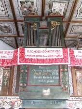
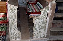
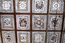
Sfăraș locality is certified since XII century, glories with a church, arisen from stones from the stronghold destroyed by the Turkish. Inside we can admire the cassetted ceiling, made by Umlig Lõrinc, in church's wall the tombstone of Veress János, one of the insurrection's leaders against king Matias. In Sfăraș castle of Szentiványi's family exists, built in XIX century.
Sights in Sfăraș
The pages of the Salaj county sightseeing were made with the aid of the Salaj County Department of Culture and National Heritage. Thanks.
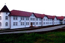
Nursing home, Photo: Módi Attila

Sfăraș, Reformed church, Photo: Módi Attila

Szentiványi mansion, Photo: Módi Attila
Sfăraș, Reformed church, Photo: Módi Attila

Sfăraș, Reformed church, Photo: Módi Attila
Sfăraș, Reformed church, Photo: Módi Attila

Szentiványi mansion, Photo: Módi Attila
Sfăraș, Reformed church, Photo: Módi Attila
Source: welcometoromania.ro
GPS: 46.90362N, 23.09580E
Map type


