Map of Bihor-Vladeasa, Apuseni mountains: Vârtop saddle - Bihorul peak
The way of the main ridge starts from the Arieșeni-Vîrtop pass, passing by the two- storeyed house of forestry, going on the forest path ahead. After 15 minutes it turns left, then after ten more minutes it gets to a streamlet, where we can refresh ourselves.
After ten minutes the road takes to the left and gets out of the forest. We have ascended 120 m so far. While climbing the next 300m we leave the road, as a glade and some serpentines follow.
After 40-60 minutes of climbing we get to 1500 m, here we turn left (do not go ahead!) and get out to the ridge. We go on the right way. After 20 min we reach the Piatra Grăitoare peak (1658m).
From here there comes a 10-15 minutes descending way to the Tarnita Bihorului saddle, from where we start to walk towards the high voltage pylons on the top of the next peak. This is called the Chicera peak. Within 30 minutes walk we can reach the Bihor Peak (1849m).
Here comes the blaze with the blue stripe.
From here our blaze, together with the red and the blue line descends to the Bihor saddle, then to the Tăul Mare lake.

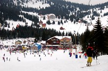
Vertop saddle, Photo: WR
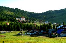
Vertop saddle, Photo: WR

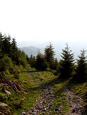
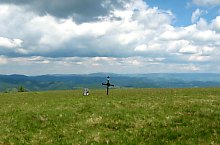
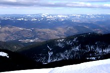
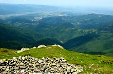
Vârtop saddle - Bihorul peak hiking trail, Bihor-Vladeasa, Apuseni mountains, Photo: WR
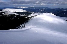
Vârtop saddle - Bihorul peak hiking trail, Bihor-Vladeasa, Apuseni mountains, Photo: Tőrös Víg Csaba

Vârtop saddle - Bihorul peak hiking trail, Bihor-Vladeasa, Apuseni mountains, Photo: Hám Péter

Vârtop saddle - Bihorul peak hiking trail, Bihor-Vladeasa, Apuseni mountains, Photo: Tőrös Víg Csaba

Vârtop saddle - Bihorul peak hiking trail, Bihor-Vladeasa, Apuseni mountains, Photo: Hám Péter

Vârtop saddle - Bihorul peak hiking trail, Bihor-Vladeasa, Apuseni mountains, Photo: Hám Péter

Vârtop saddle - Bihorul peak hiking trail, Bihor-Vladeasa, Apuseni mountains, Photo: Tőrös Víg Csaba

Vârtop saddle - Bihorul peak hiking trail, Bihor-Vladeasa, Apuseni mountains, Photo: Tőrös Víg Csaba

Vârtop saddle - Bihorul peak hiking trail, Bihor-Vladeasa, Apuseni mountains, Photo: Boros Zoltán

Vârtop saddle - Bihorul peak hiking trail, Bihor-Vladeasa, Apuseni mountains, Photo: Mircea Munteanu

Vârtop saddle - Bihorul peak hiking trail, Bihor-Vladeasa, Apuseni mountains, Photo: Tőrös Víg Csaba

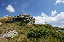
Piatra Grăitoare, Photo: Hám Péter
Vârtop saddle - Bihorul peak hiking trail, Bihor-Vladeasa, Apuseni mountains, Photo: Hám Péter

Vârtop saddle - Bihorul peak hiking trail, Bihor-Vladeasa, Apuseni mountains, Photo: Hám Péter

Vârtop saddle - Bihorul peak hiking trail, Bihor-Vladeasa, Apuseni mountains, Photo: Hám Péter
Vârtop saddle - Bihorul peak hiking trail, Bihor-Vladeasa, Apuseni mountains, Photo: Tőrös Víg Csaba

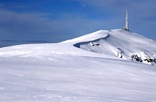
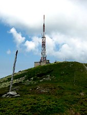
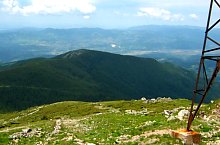
Bihorul peak, Photo: Hám Péter
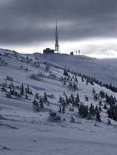
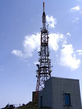
Bihorul peak, Photo: Hám Péter
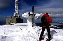
Bihorul peak, Photo: Hám Péter

Bihorul peak, Photo: Hám Péter
Bihorul peak, Photo: Hám Péter

Bihorul peak, Photo: Tőrös Víg Csaba

Bihorul peak, Photo: Tőrös Víg Csaba
Bihorul peak, Photo: Hám Péter
Bihorul peak, Photo: Hám Péter

Bihorul peak, Photo: Boros Zoltán
Bihorul peak, Photo: Tőrös Víg Csaba
Bihorul peak, Photo: Boros Zoltán

Bihorul peak, Photo: Tőrös Víg Csaba

Bihorul peak, Photo: Vasile Coancă

Bihorul peak, Photo: Vasile Coancă
Vârtop saddle - Bihorul peak hiking trail, Bihor-Vladeasa, Apuseni mountains, Photo: Tőrös Víg Csaba
Vârtop saddle - Bihorul peak hiking trail, Bihor-Vladeasa, Apuseni mountains, Photo: Mircea Munteanu
Vârtop saddle - Bihorul peak hiking trail, Bihor-Vladeasa, Apuseni mountains, Photo: Tőrös Víg Csaba
Source: welcometoromania.ro
GPS: 46.48390N, 22.67355E
Map type