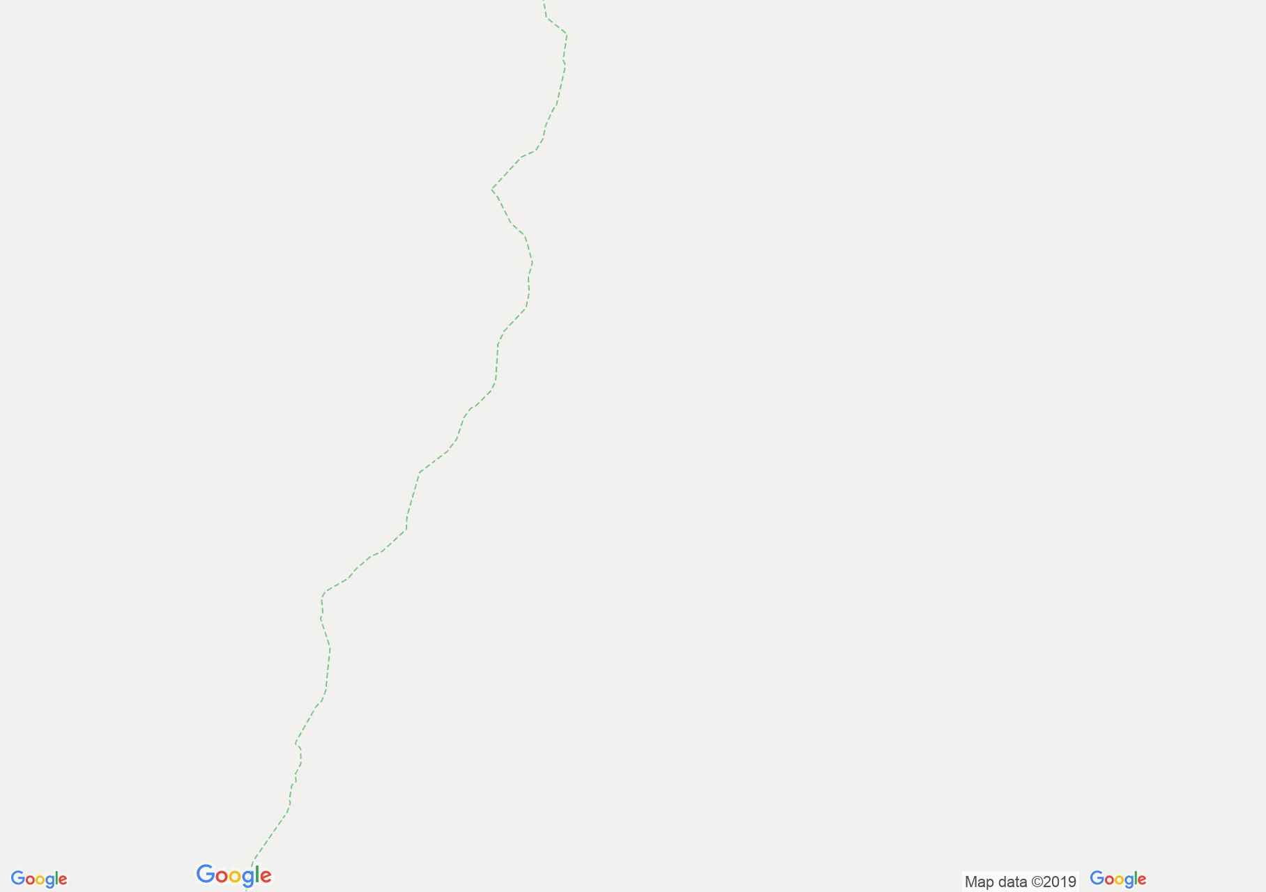
Map of Făgăraş mountains: Piscul Negru - Buda valley
From Negru Peak Chalet we follow the national road upstream. At km 104, 1200 m altitude, we mark our blue cross mark. We ascend a level difference of 300 m and below the peak Piscul Negru (2248m) cotim to the right. The mark follows the water line between the Capra and Museteica valleys. We pass by Jorzea peak and soon we start descending on the foot of this mountain up to 1800 m altitude where the marker turns to the right and bypassing the basin of Cornea brook we get to Naneasa glade. From here, we have to lower 600 meters of level difference to the forest road in the valley of the Buda river.

Piscul Negru, Photo: Rogojanu Florin
Piscul Negru, Photo: Rogojanu Florin

Piscul Negru, Photo: Salvamont Argeș

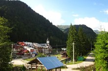
Piscul Negru - Buda valley hiking trail, Făgăraș mountains, Photo: Robert Mihai

Piscul Negru - Buda valley hiking trail, Făgăraș mountains, Photo: Robert Mihai

Piscul Negru - Buda valley hiking trail, Făgăraș mountains, Photo: Robert Mihai

Piscul Negru - Buda valley hiking trail, Făgăraș mountains, Photo: Bogdan Căpățînă

Piscul Negru - Buda valley hiking trail, Făgăraș mountains, Photo: Robert Mihai

Piscul Negru - Buda valley, Photo: Clubul de turism Argessis

Piscul Negru - Buda valley, Photo: Clubul de turism Argessis
Source: welcometoromania.ro
GPS: 45.53306N, 24.63073E
Map type