Hartă Răchiţele: Răchiţele
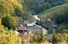
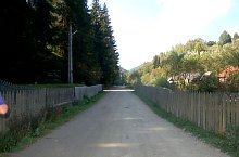
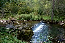
Localitatea Răchițele situată pe drumul județean Bologa-Padiș este punctul de pornire a drumului asfaltat care urcă până la cascada Răchițele, situată în versantul estic al masivului Vlădeasa, pe Valea Seacă. Distanța până la cascadă este de 6 km.
Accesibil din traseul:

Rachitele , Foto: WR
Rachitele , Foto: WR

Rachitele , Foto: WR

Rachitele , Foto: WR
Rachitele , Foto: WR

Rachitele , Foto: WR

Rachitele , Foto: WR

Rachitele , Foto: WR
Rachitele , Foto: WR

Rachitele , Foto: WR
Sursa: welcometoromania.ro
GPS: 46.71537N, 22.89469E
pag. 1
<
>
Tip hartă


