Map of Benesat: The lake
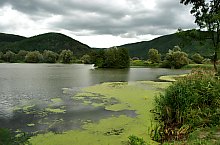
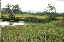
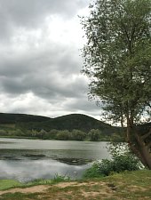
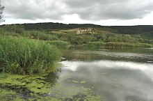
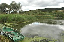
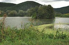
The Benesat lake has a surface of 4,5 ha and it is situated at a distance of 50 m of Someș. It was formed as the result of the floodings from 1970 and then by dredging. The average depth is of 2 m, and the maximum depth is of 3 m. Since 2003 it is leased and guarded 24/7.
The fishing is allowed only if you pay. In 2003-2004 it was populated with carp and crucian but you can fish sheat fish, pike, pike perch and perch also. On the bank there is bulrush, reed and willows.

The lake, Benesat , Photo: WR

The lake, Benesat , Photo: WR
The lake, Benesat , Photo: WR

The lake, Benesat , Photo: WR
The lake, Benesat , Photo: WR

The lake, Benesat , Photo: WR

The lake, Benesat , Photo: WR
The lake, Benesat , Photo: WR

The lake, Benesat , Photo: WR

The lake, Benesat , Photo: WR

The lake, Benesat , Photo: WR
The lake, Benesat , Photo: WR
The lake, Benesat , Photo: WR
The lake, Benesat , Photo: WR
Source: welcometoromania.ro
GPS: 47.41197N, 23.29973E
Map type