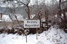
Map of Bicălatu
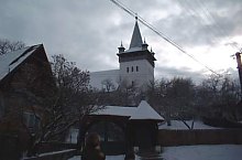
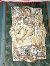
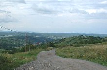
Bicălatu locality is certified since 1249, prides with a reformat church built in 1402. At 1.5 km distance from the village extremity the locality's fortress was made: Wolves' fortress. Unfortunately in present its remains can hardly be seen.
Bicălatu, sights
The pages of the Salaj county sightseeing were made with the aid of the Salaj County Department of Culture and National Heritage. Thanks.
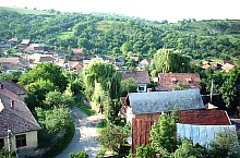
Bicălatu , Photo: Lutz Fischer-Lamprecht
Bicălatu , Photo: Lutz Fischer-Lamprecht
Bicălatu , Photo: Lukacs Endre
Bicălatu , Photo: Petru Suciu
Bicălatu , Photo: Petru Suciu
Bicălatu , Photo: Lutz Fischer-Lamprecht

Bicălatu, Reformed church, Photo: Szabó Tibor

Bicălatu, The fortress, Photo: Szabó Tibor
Source: welcometoromania.ro
GPS: 46.87862N, 23.04879E
Map type


