Map of Runcuri plateau: Runcuri table-land
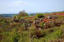
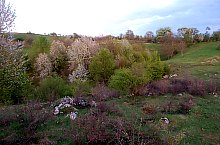
Runcuri table-land is situated north to the Roșia locality, between Cuților and Albioarei Narrows and with the two pits: Ciurului and Doboș, belongs to the Ciur-Izbuc-Ciur-Ponor-Toplița fount karst system. It's an approximaley 7kmp table-land, full of hills, valleys, glens and ditches. These ditches appear only on the table-lands belonging to the karst areas, on the margin of the glen funnel, where the topsoil is not thick enough to cover the calcareous rocks. The table-land's hydrogeological system is supplied by all the water losses from the table-land's surface and also by the waters of Tinoasa brook.
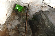
The karst springs - the founts - are located at the table-land's periphery; the most important is Roșia Toplița fount. The activity of the waters created some caves of great scientific and touristic importance: Ciur-Izbuc, Ciur-Ponor, Doboș and we can continue with those from the slopes of the two narrows area, Albioarei and Cuților, an integral part of this karst system.

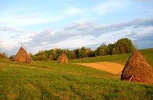
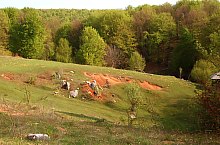
Runcuri table-land, Runcuri plateau , Photo: WR

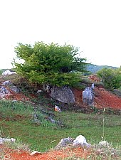
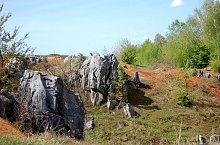
Runcuri table-land, Runcuri plateau , Photo: WR
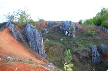
Runcuri table-land, Runcuri plateau , Photo: WR

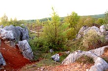
Runcuri table-land, Runcuri plateau , Photo: WR

Runcuri table-land, Runcuri plateau , Photo: WR

Runcuri table-land, Runcuri plateau , Photo: WR

Runcuri table-land, Runcuri plateau , Photo: WR

Runcuri table-land, Runcuri plateau , Photo: WR

Runcuri table-land, Runcuri plateau , Photo: WR
Runcuri table-land, Runcuri plateau , Photo: WR
Runcuri table-land, Runcuri plateau , Photo: WR
Runcuri table-land, Runcuri plateau , Photo: WR

Runcuri table-land, Runcuri plateau , Photo: WR
Runcuri table-land, Runcuri plateau , Photo: WR
Runcuri table-land, Runcuri plateau , Photo: WR

Runcuri table-land, Runcuri plateau , Photo: WR

Runcuri table-land, Runcuri plateau , Photo: WR
Runcuri table-land, Runcuri plateau , Photo: WR

Runcuri table-land, Runcuri plateau , Photo: WR
Runcuri table-land, Runcuri plateau , Photo: WR
Source: welcometoromania.ro
GPS: 46.84498N, 22.39072E
Map type