Map of Runcuri plateau: Ciur Ponor cave
Ciur Ponor Cave belongs to the most fascinating karst system from the Apuseni Mountains. Tinoasa brook, which springs from the Tinoasa hill, is swallowed by the Tinoasa slope, passes through the Ciur-Izbuc cave, after the outlet from the cave it receives the Ciurului brook and enters the Ciur-Ponor cave. After a subterranean route of 15 km it outcrops through the Roșia Toplița fount. The divers in 1983-1984 exceeded 8 siphons; working out the junction with the Toplița cave they reached a total length of the system of 14.9 km.
From this length 7700m is seized by an active subterranean course. The exploitation of the cave is strongly connected to the dear departed diver-speleologist Halasi Gabor. Ciur Ponor is characterized by a great variety of the typical constitution.
Contact
Tel : 0040-727-138-029
speocristal@yahoo.com
You can speak with us in: English, Romanian, French, Italian

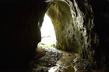
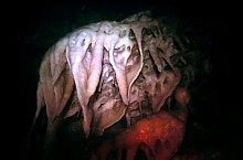
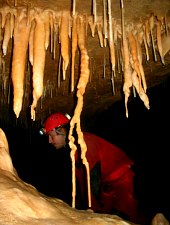
Ciur Ponor cave, Runcuri plateau , Photo: Cristina Ianc
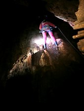
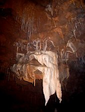
Ciur Ponor cave, Runcuri plateau , Photo: Tőrös Víg Csaba

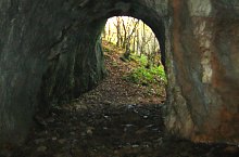
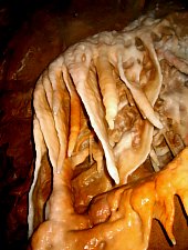
Ciur Ponor cave, Runcuri plateau , Photo: Tőrös Víg Csaba

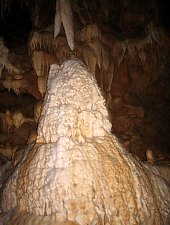
Ciur Ponor cave, Runcuri plateau , Photo: Cristina Ianc
Ciur Ponor cave, Runcuri plateau , Photo: Tőrös Víg Csaba

Ciur Ponor cave, Runcuri plateau , Photo: Cristina Ianc
Ciur Ponor cave, Runcuri plateau , Photo: Cristina Ianc

Ciur Ponor cave, Runcuri plateau , Photo: Cristina Ianc
Ciur Ponor cave, Runcuri plateau , Photo: Cristina Ianc
Ciur Ponor cave, Runcuri plateau , Photo: Cristina Ianc

Ciur Ponor cave, Runcuri plateau , Photo: Tőrös Víg Csaba

Ciur Ponor cave, Runcuri plateau , Photo: Cristina Ianc

Ciur Ponor cave, Runcuri plateau , Photo: Cristina Ianc

Ciur Ponor cave, Runcuri plateau , Photo: Cristina Ianc

Ciur Ponor cave, Runcuri plateau , Photo: Cristina Ianc
Ciur Ponor cave, Runcuri plateau , Photo: Cristina Ianc

Ciur Ponor cave, Runcuri plateau , Photo: Cristina Ianc
Ciur Ponor cave, Runcuri plateau , Photo: Cristina Ianc

Ciur Ponor cave, Runcuri plateau , Photo: Cristina Ianc
Source: welcometoromania.ro
GPS: 46.84848N, 22.39067E
Map type