Map of Predeal: Clăbucet sosire ski-run
Difficulty
easy
Length
800 m
Tilt
20 degree
Diff. of height
160 m
Illuminated
yes
Transport
Telesky
Snow cannon
yes

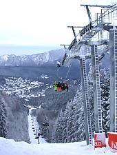
Predeal, Clăbucet sosire, Photo: Radu Pușcașu

Predeal, Clăbucet sosire, Photo: Radu Pușcașu

Predeal, Clăbucet sosire, Photo: Radu Pușcașu

Predeal, Clăbucet sosire, Photo: Radu Pușcașu

Predeal, Clăbucet sosire, Photo: Radu Pușcașu

Predeal, Clăbucet sosire, Photo: Radu Pușcașu

Predeal, Clăbucet sosire, Photo: Radu Pușcașu

Predeal, Clăbucet sosire, Photo: Radu Pușcașu

Predeal, Clăbucet sosire, Photo: Radu Pușcașu

Predeal, Clăbucet sosire, the snow cannon
Source: welcometoromania.ro
GPS: 45.49680N, 25.58059E
pag. 1
<
>
Map type