Map of Homoród Bath
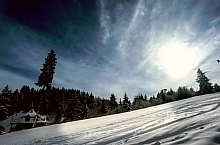
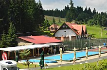
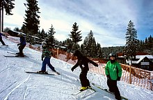
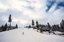
The settlement is at 825-890 m. On the upper course of the Homorodul Mic River. Summer average temperature is between 19-21 degrees. It is an area rich in precipitation. The snow captures these lands in the period from November to May, and is the favorite place for skiers. The resort has 6 springs of mineral water, known since the 19th century, when it becomes a resort with famous baths. Between the two world wars many villas were built. There were also 2 pools, two exist now. Springs with mineral rich waters are indicated for the treatment of digestive tract diseases.
The resort is surrounded by woods and hardwoods, sprinkled with shadows, a favorite area of wild animals. Thus hikers often meet with ravens, rabbits, squirrels.
Homoród Bath , Photo: WR

Homoród Bath , Photo: WR

Homoród Bath , Photo: WR
Homoród Bath , Photo: WR

Homoród Bath , Photo: WR
Homoród Bath , Photo: László János
Homoród Bath , Photo: László János
Homoród Bath , Photo: Lobogó panzió

Homoród Bath
Homoród Bath , Photo: WR

Homoród Bath , Photo: László János

Homoród Bath , Photo: Muszka János

Homoród Bath , Photo: WR
Source: welcometoromania.ro
GPS: 46.34967N, 25.46870E
Map type