Map of Făgăraş
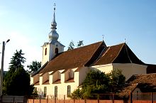
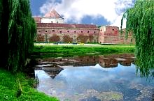
The first records in 1291 speak of Fogros. The more than 500 year old fortress became the symbol of the town. The first fortress was made of wood and surrounded by dirt embankments, but after several transformations it grew to be real stronghold, resisting to all kinds of enemies. In the Middle Ages the town boomed and for a century it becomes the seat of rulers. Today it can pride in one of the most well preserved fortress in Transilvania.

Făgăraș
Source: welcometoromania.ro
GPS: 45.84342N, 24.97184E
pag. 1
<
>
Map type