Map of Retezat mountains: Pietrele - Lolaia peak - Retezat peak
The yellow band-marked route immediately begins its climb. After a series of serpentines comes out to the top of the forest, and after more than an hour of difficult climbing it reaches the peaks of Lolaia. So far, we have climbed nearly 300 m in level difference.
We climb a group of cliffs, cross a juniper area and get to the Ciurila saddle. Here, at a distance of 100 m to the west, it is a spring.
The climb continues up to the summit of Lolaia (2180m), from here we go down a little and to climb again to 2278m on the southern tip of Lolaia, from where it follows a more difficult downhill to Lolaia saddle (2225m). Here we meet:
Here we meet
The redband joins us. After a short stop, we are expecting a new climb on the Retezat slabs to the top of 2482m. From here:
Jnepeni, Photo: Herman László

Mountain flowers, Photo: Ștefan Pușcașu

The Lolaia crest, Photo: Mihai Bursesc

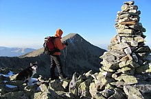
Lolaia peak, Photo: Ștefan Pușcașu

Lake and pond Stănișoara, Photo: Ștefan Pușcașu

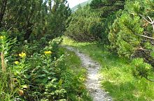
The path to Lolaia, Photo: Ștefan Pușcașu

:o;aia peak, Photo: Ștefan Pușcașu

The Lolaia crest, Photo: Mihai Bursesc

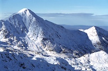
The Retezat peak is already visible, Photo: Ștefan Pușcașu

The Lolaia crest, Photo: Márton Róbert

The path to Retezat, Photo: Radu Dârlea

The path to Retezat, Photo: Radu Dârlea

The path to Retezat, Photo: Radu Dârlea

The path to Retezat, Photo: Radu Dârlea

Stevia lake, Photo: Márton Róbert

The path to Retezat, Photo: Mihai Bursesc

The path to Retezat, Photo: Mihai Bursesc
Retezat peak, Photo: Silvia David

Retezat peak, Photo: Mihai Păcuraru
Retezat and Vf. Lolaia peaks, Photo: Sorin Rechițan

Retezat peak from de Bucura saddle, Photo: Alin Marinică
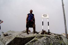
Retezat peak, Photo: Radu Dârlea
Source: welcometoromania.ro
GPS: 45.39584N, 22.85603E
Map type


Retezat mountains: Râuşor - Ştevia - Retezat peak
Retezat mountains: Pietrele - Stânişoarei vale - Retezat peak
Retezat mountains: Pietrele - Lolaia peak - Retezat peak

Retezat mountains: Stânişoara waterfall
Retezat mountains: Râuşor - Pietrele lodge
Retezat mountains: Pietrele - Stânişoarei vale - Retezat peak