Map of Retezat mountains: Pietrele - Stânişoarei vale - Retezat peak
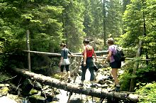
The trail marked with a triangle and a blue cross starts from Pietrele, crosses the glade, at the top end, approaches the stream and over 15 minutes passes the deck. After an easier climb we leave the blue cross
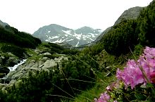
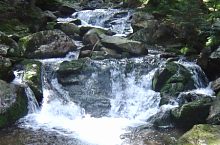
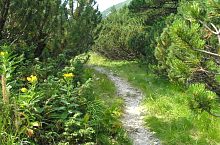
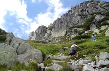
We start the climb up to the glacier threshold. To the left of the trail, the stream descends in the waterfalls between the huge groves. We're crossing the area with big rock blocks, and jnepeni and we get to the next step.
In a little while we have the choice, we go to the upper or lower one, which passes through the little key La Borduleț, then we go down to the Lunca Stânișoarei, we pass the water and an uphill takes us to Stănișoara Lake (2000m). From here we get into the rocky area without water. We arrive at the base of the Hornul Mare, from where you can see the zigzag of the path, which takes us to Retezat's saddle (2251m). Here are the:
From the saddle we join the yellow band mark, we have to climb the huge slabs approx. 30-40 minutes to the Retezat Peak (2482m). From here starts:
The stream, Photo: Mihai Bursesc

The glade, Photo: Diana Bălteanu

The glacier threshold, Photo: Bursesc Mihai

Stânișoara, Photo: Alin Marinică
The stream, Photo: Radu Dârlea

Stânișoara lake, Photo: Herman László
Jnepeni, Photo: Herman László
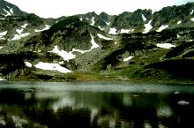
Stânișoara lake, Photo: Mihai Bursesc

Stânișoara lake, Photo: Tudor Predescu

Stânișoara lake, Photo: Mihai Bursesc

Stânișoara lake, Photo: Herman László

Stânișoara lake, Photo: Radu Dârlea
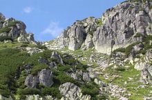
The chimney, Photo: Radu Dârlea
The climb in the chimney, Photo: Radu Dârlea

Retezat saddle, Photo: PNR
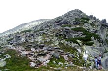
Retezat saddle, Photo: Radu Dârlea

Panorama from the saddle, Photo: Herman László
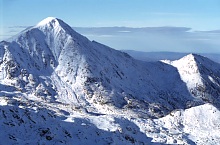
Retezat and Lolaia peaks, Photo: Sorin Rechițan

The Retezat peak from the Bucura saddle, Photo: Alin Marinică

Retezat, Photo: Dragoș Lică

Ridge, Photo: Radu Dârlea
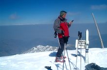
Skier on Retezat Peak, Photo: Daniel Bal

Retezat, Photo: Radu Dârlea
Source: welcometoromania.ro
GPS: 45.39302N, 22.86268E
Map type